Numerical Models
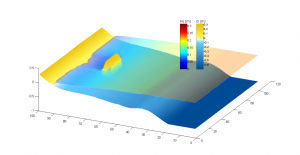
COD is a 2-dimensional (2D) depth-averaged beach evolution numerical model used to study of medium-to-long-term (days, years) and meso-to-macroscale (hundreds of meters to kilometers) morphological changes under the action of wind waves only over the arbitrary land and sea topographies around existing coastal structures and formations.
CSES
CSIM: Coastline-Structure Interaction
CSIM is a one-dimensional numerical shoreline evolution model used to simulate the shoreline changes considering structure interference. CSIM may be applied for longshore sediment transportation problems and to simulate shoreline changes that occur due to most of the coastal defense structures.
Fuzzy Coastal Vulnerability Assessment Model is built upon Coastal Vulnerability Index (CVI) approach to evaluate the vulnerability of coastal areas integrating the physical characteristics with the effect of human activities. FCVAM uses fuzzy inference to assess coastal vulnerability for coastal erosion, coastal flooding, inundation because of sea level rise, saltwater intrusion to rivers and groundwater resources. The database the inference is derived from and the combined vulnerability score enhances the model’s capability to prioritize several coastal areas from a local scale to across countries.
ibmPorFoam is a numerical flow solver for wave-porous structure interaction problems based on the open-source computational fluid dynamics library OpenFOAM®. ibmPorFoam solves Volume-Averaged Reynolds-Averaged Navier-Stokes Equations, and it uses the immersed boundary method to impose the solid boundaries in the computational domain.
NAMIDANCE

